- Club Pickle and Padel Dome – Park District of Highland Park
- Malcolm X College Stormwater Vault Replacement
- Northwood Street and Utility Improvements – Village of Buffalo Grove and Vernon Township
- Nippersink Road Improvements Project – Phase II
- Buffalo Grove High School Athletic Field Construction – Township High School District 214
- Looking Ahead
Each year, the Construction and Survey Division gathers to review the work that shaped the past twelve months. Individuals present projects that stood out, not only for what was built, but for what the experience revealed. Those discussions focus on challenges, learning moments, and the practical realities of the work.
What comes out of those presentations often goes beyond schedules or quantities. The same project looks different depending on experience, responsibility, and where time was spent in the field. A coordination challenge for one person may mark a first major learning moment for another.
As Assistant Director of Construction and Survey, Lucas Deferville sees those conversations as an extension of day-to-day practice. “Each of these projects brought its own constraints,” Deferville said. “What stands out is how often decisions in the field were shaped by coordination, timing, and an understanding of how one piece of work affects everything around it. That’s where a lot of the real learning happens.”
Club Pickle and Padel Dome – Park District of Highland Park
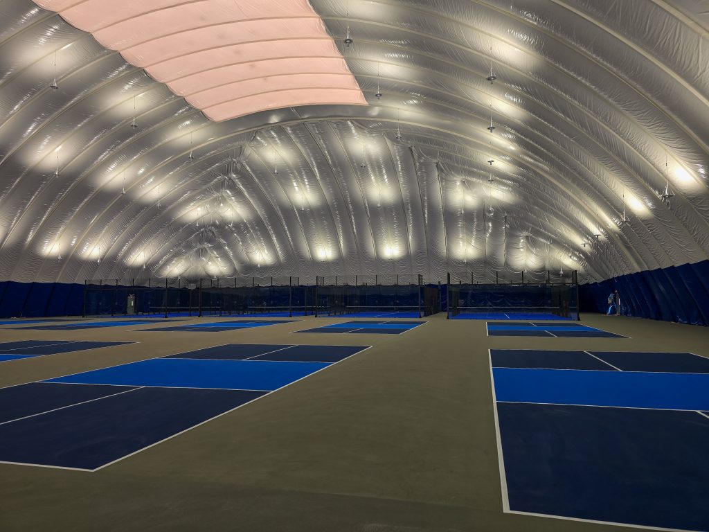
Work at the Club Pickle and Padel Dome for the Park District of Highland Park unfolded within a set of constraints rarely encountered on typical construction projects. A portion of site work occurred within the footprint of a future pressurized inflatable structure, positioned over a former landfill. The enclosed environment influenced access and sequencing, while buried debris and environmental considerations required ongoing field coordination.
Primary site and paving work within the dome footprint took place across multiple phases of the project. Asphalt paving, sidewalks, and ADA routes were completed early, with later enclosure conditions influencing how finishes and transitions were handled. Once the dome was in place, interior work was more targeted, including HMA color coating, limited utility excavation, and select concrete pours, all performed within a pressurized environment.
Subsurface work reflected the site’s landfill history. Excavation encountered buried debris, requiring environmental coordination and controlled handling of material. Excavated soil could not be removed immediately and was temporarily stockpiled on site, with drone surveys used to document conditions and calculate quantities for removal and replacement. “You never really know what you’re going to run into on a site like this,” Construction Engineer Griffin Boo said. “Once work was underway, it was about coordinating quickly and making sure adjustments didn’t affect other parts of the site.”
“Working inside the dome ties everything together,” Griffin said. “Access, ventilation, and sequencing all happen in the same space, so once something’s set, the next work is already depending on it.” That shaped how verification was handled on site. Connections were checked against finished grades, with rim and invert elevations confirmed in the field before work advanced. Those verifications locked in key elevations that subsequent paving and interior transitions had to match as work advanced.
Malcolm X College Stormwater Vault Replacement
The Malcolm X College Stormwater Vault Replacement project stems from long-standing drainage issues that have affected lower levels of the campus for years. Aging stormwater vaults provided limited storage and allowed groundwater infiltration, contributing to recurring basement flooding during significant rain events. Addressing those conditions required a coordinated replacement of the underground storage system.
Construction took place in the middle of a busy urban campus, with crews working around daily activity and constant pedestrian traffic. Dense utilities and limited access shaped how demolition, bypass pumping, and new construction were sequenced, with each phase planned to keep the surrounding campus functional while underground work progressed.
As excavation moved forward, field conditions frequently diverged from record information. Crews encountered abandoned ductile iron water mains, active duct banks, and tightly clustered sanitary and storm sewer infrastructure, all within a limited work zone. “On a site like this, you have to treat everything as connected from the start,” Construction Engineer John Eisenhut said. “Any adjustment affects traffic, access, and the utilities around it, so decisions can’t be made in isolation.”
Maintaining stormwater flow dictated the sequencing. Temporary bypass systems were installed using eight-, sixteen-, and eighteen-inch PVC piping with watertight boot connections, with field adjustments made to maintain slope and clear existing infrastructure. Angled ductile iron fittings were used where offsets were required, and bypass systems had to be fully operational before vault demolition could begin. As John explained, confidence was essential. “You had to know the bypass was doing exactly what it was supposed to do before touching the permanent system,” he said, “because there wasn’t room to lose capacity, even temporarily.
Northwood Street and Utility Improvements – Village of Buffalo Grove and Vernon Township
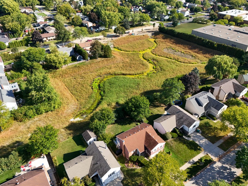
The Northwood Street and Utility Improvements project brought together a broad cross-section of the Construction and Survey Division, with experienced staff and newer team members working side-by-side on a project where coordination mattered as much as construction itself. Decisions in the field had to account for how each element fit into a larger system. That system extended beyond a single client, with the Village of Buffalo Grove and Vernon Township coordinating drainage improvements across a shared watershed that served the surrounding neighborhood. Drainage modeling completed as part of the Village’s stormwater planning had shown that flooding issues could not be addressed in isolation. Conveyance improvements along Horatio Boulevard, drainage deficiencies at low points on adjacent streets, and storage within nearby basins all had to function together to achieve measurable results.
Construction was organized around that system-wide coordination. Large-diameter storm sewer installation established the framework, with roadway reconstruction, water main replacement, and basin modifications coordinated around it. Work extended beyond the roadway itself into Northwood Park and Ridgewood Basin, where additional stormwater storage was incorporated as functional infrastructure rather than standalone restoration. All of it occurred within a single construction window, leaving no room for rework in an active residential setting. As Engineering Technician Nico Cascella noted, keeping multiple scopes aligned was essential. “This project impacted a lot of systems at once,” he said. “Storm sewer, roadway, utilities, restoration. Being part of that coordination made the work especially rewarding.”
Survey coordination was essential given the number of control systems in play across the project. Roadway geometry, ADA improvements, storm sewer elements, and park grading relied on different control frameworks, and those boundaries had to remain clear in the field. Land Surveyor Jim Ricker emphasized that clarity as a prerequisite for progress. “The biggest focus was making sure nothing crossed control lines,” Ricker said. “Clarity around which control applied where kept layout and elevations consistent across the site.”
For staff early in their careers, Northwood provided a firsthand look at how those disciplines intersect during construction. As a survey intern on the project, Chris Oliver described the experience as formative, particularly seeing how survey, inspection, and construction decisions influenced one another in real time. “It was the first project where I really saw how everything has to line up,” he said. “It gave me a deeper appreciation for the coordination required on work that looks straightforward on paper.”
The project was built around an understanding of how the system would be used, not just how it would be constructed. That perspective influenced field decisions and resulted in improvements meant to serve the area well into the future.
Nippersink Road Improvements Project – Phase II
Accuracy was the controlling factor on Phase II of the Nippersink Road Improvements project, where survey work supports a formal IDOT process through preparation of the Plat of Highway. Spanning roughly 10,000 feet from IL 134 to Wilson Road, the work focuses on documenting existing right-of-way, parcel boundaries, and acquisition limits as part of an ongoing Phase II effort tied to future roadway improvements in Grant Township and the Village of Fox Lake.
As the corridor took shape, the scale of the coordination became clearer. Survey data for the Plat of Highway had to align precisely with record plats, title commitments, easements, and legal descriptions, with little tolerance for inconsistency across parcels. “Once you start laying everything out across a corridor like this, you see how small discrepancies can add up,” Engineering Technician Mariano Garcia said. “The length of the corridor makes consistency with the records especially important.”
Phase II survey work along the Nippersink corridor is establishing the formal record framework that will carry forward into design and construction. “This project is a good example of how survey supports more than just layout,” Jon Past, PLS, Survey Group Leader, said. “It provides the structure that allows roadway improvements to be planned, reviewed, and delivered in a way that holds together over time and leads to practical solutions.”
Buffalo Grove High School Athletic Field Construction – Township High School District 214
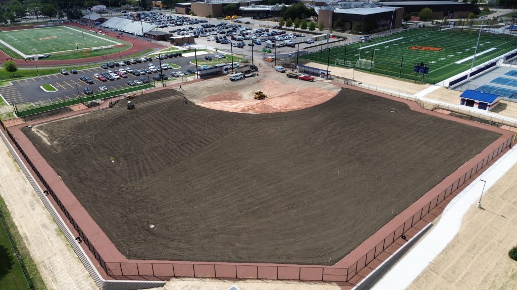
The athletic field improvements at Buffalo Grove High School are part of a larger, multi-phase construction effort, with this past year marking the second phase of construction. Work during this phase focused on building the stormwater and grading infrastructure needed to support future field improvements, including installation of new storm sewers serving approximately 4.75 acres of the site. Construction included reinforced concrete and HDPE pipe ranging from 8 to 24 inches in diameter, new catch basins and manholes, and a control and overflow structure designed to regulate on-site discharge.
Because portions of the baseball field extend over areas that previously functioned as detention, surface restoration followed directly from the grading and drainage work completed earlier in the phase. Field areas were rebuilt after underground systems were installed, beginning with scarification and placement of imported topsoil to achieve the required profile. Soil amendments and irrigation installation were coordinated as part of that effort, followed by staged sod placement as adjacent work reached completion. Ongoing establishment and maintenance supported long-term performance, with restored surfaces following the grades and drainage patterns set during construction.
Engineering Technician Andy Yeaman noted that this phase required thinking beyond individual work items. “Once the drainage systems and grades are in place, they set the rules for everything that follows,” he said. “This phase was about getting those fundamentals right so the rest of the project could move forward without fighting the site.”
Looking Ahead
Across these projects, teams worked through different site conditions, scopes, and timelines, but the common thread was how decisions in the field shaped outcomes. Each effort adds another layer of experience that informs future work.
“The real value comes from applying what we learn from one project to the next,” Dave Marquardt, Director of Construction and Survey said. “That shared experience helps our teams make better decisions in the field and deliver dependable, long-last results for the communities we serve.”